
The Kingdom of Ashwood Map
One of the most rewarding and enjoyable parts of bringing this story to life was creating a map for the world it’s set in. I was very fortunate to work with Jamie Whyte, a brilliant cartographer whose work has appeared in such respected tomes as The Illustrated World of Tolkien. There’s something incredibly special and wonderfully satisfying about seeing a world you’ve carried in your head for years laid down on paper, beautifully and professionally realised. Read on to see how it evolved from rough sketch to finished version!


Hover with your mouse or pinch with your fingers to zoom in.

Creating a Fantasy World Map:
From Sketch to Final Illustration
Click or tap the map to open it full screen and zoom in.

Draft 1: outlining the general shape of the Divided Isle, focussing on the Kingdom of Ashwood, and positioning some of the key settlements.

Draft 2: adding in some lakes near the city of Goshawk, and some additional goblin islands off the south-east coast.
This was my brief to Jamie for the islands: ‘I picture the goblins’ territory as a jagged stretch of coves, sea caves, rocky inlets, and a spatter of tiny, treacherous islands just offshore and extending out to sea. The coastline is rough and irregular, with clusters of small islands close to the mainland, giving the impression of land and sea blurring in a chaotic sprawl.’
You can see just how well Jamie was able to bring my vision to life!
This was my brief to Jamie for the islands: ‘I picture the goblins’ territory as a jagged stretch of coves, sea caves, rocky inlets, and a spatter of tiny, treacherous islands just offshore and extending out to sea. The coastline is rough and irregular, with clusters of small islands close to the mainland, giving the impression of land and sea blurring in a chaotic sprawl.’
You can see just how well Jamie was able to bring my vision to life!
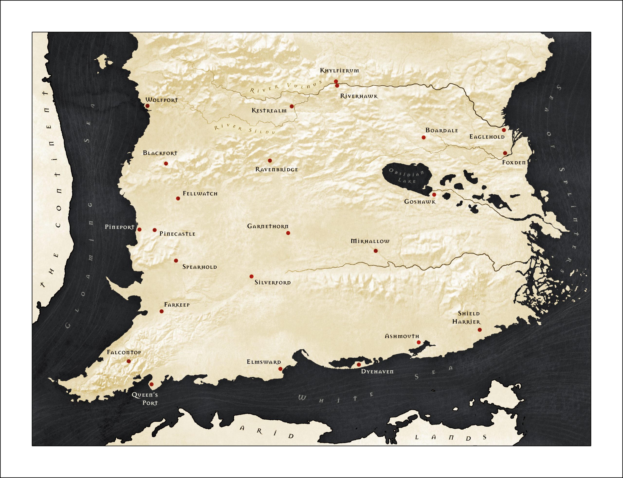
Draft 3: introducing mountain ranges into the landscape, helping to shape the broader geography and deepen the sense of scale and realism across the island.

Draft 4: adding in forests and grasslands - the part I was most excited for! Magical, primeval forest covers much of the Kingdom of Ashwood, shaping travel, politics, trade, culture, how war is waged and much more, so this addition was what was really going to bring the map to life in my eyes. The grasslands also have an outsized impact on power dynamics and defence considerations within the kingdom, providing, as they do, clear, direct access from the coast straight to the capital of Riverhawk.
This draft also had another exciting update: the demarcation of the smaller kingdoms in the south of The Divided Isle: the Troll, Minotaur, Goblin and Centaur territories (to receive their actual names in the next draft!)
This draft also had another exciting update: the demarcation of the smaller kingdoms in the south of The Divided Isle: the Troll, Minotaur, Goblin and Centaur territories (to receive their actual names in the next draft!)
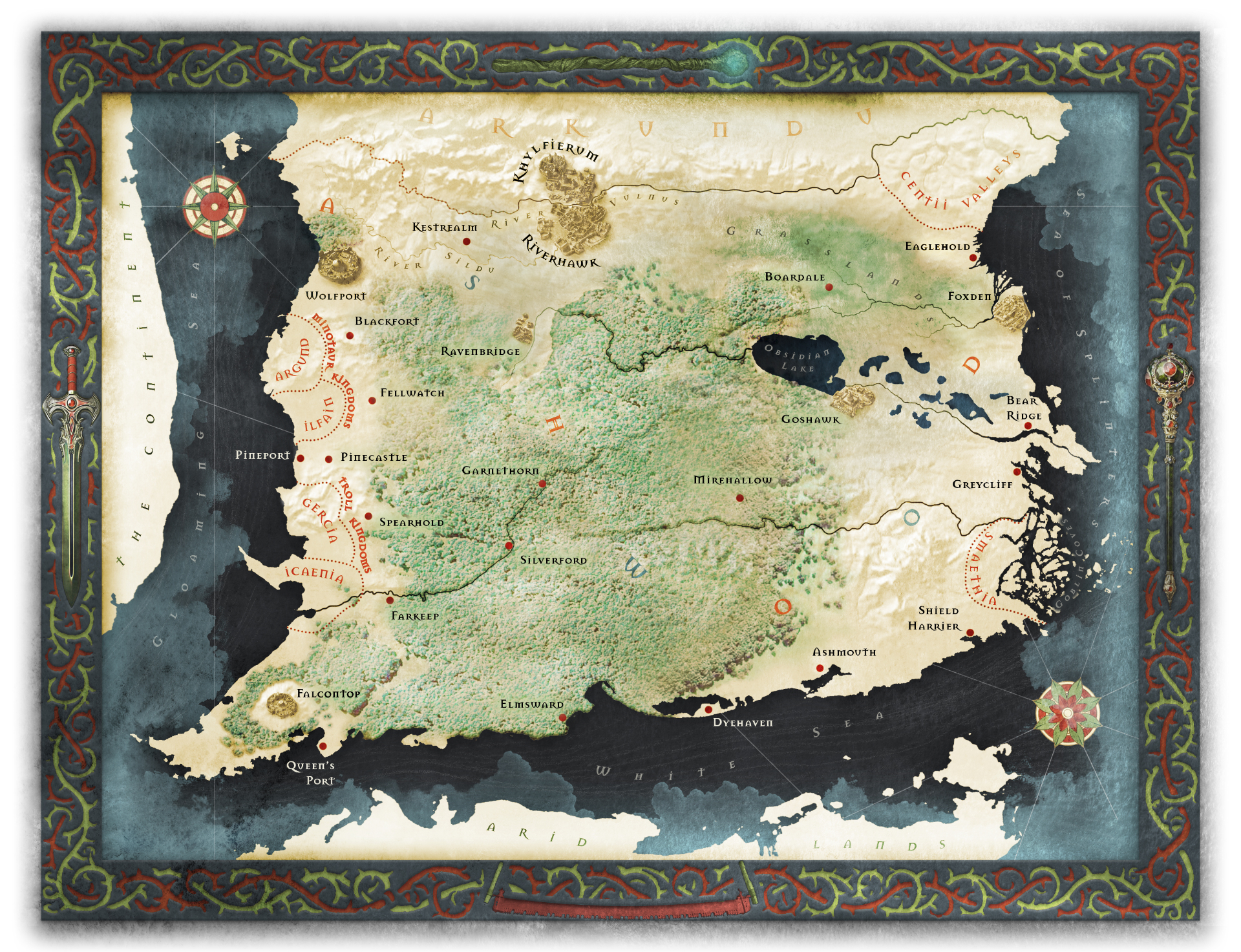
The final map!: adding in beautifully depicted settlements, a spectacular frame and magnificent wind roses! These finishing touches took the map from a detailed and realistic depiction of my world into a work of art that blew all my expectations out of the water. I especially love how the frame at the very bottom includes a carpenter’s saw. Solar, the hero of Witchcraft and Fury, is of humble origin: her father is a carpenter and, before her star begins to rise, Solar makes ends meet through petty crime. To have a saw shown in the same frame as a finely wrought sword, magician’s staff and royal sceptre captures that perfectly.